Using Nautical Charts
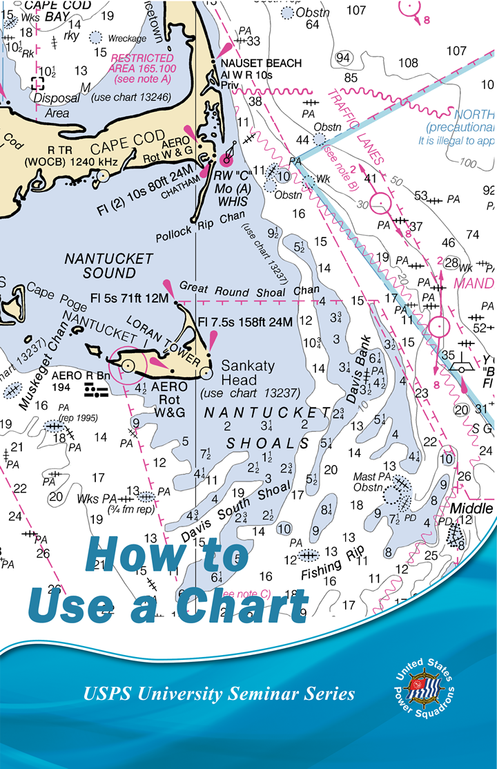
Learn the basics of reading and using a nautical chart for safe boating whether you’re cruising, going fishing, or just out for the day. Charts include must-have information, including bottom contours, hazards, and aids to navigation, to help you travel safely.
What's included?
- What charts show navigators above the water
- Chart features
- Chart scales
- What charts show navigators below the water
- Aids to navigation
- Latitude and longitude
- Planning your course
- What's in your way
This seminar is also available online.